Rivers and pollutionGuide
Russian River flood stage: what 32 feet means at Guerneville, and what floods at each level
On February 27, 2019, the Russian River at Guerneville rose past 45 feet and cut the town off. Flood stage on that gauge is 32 feet. 35 feet is a moderate flood and 40 feet a major one. Here is what floods at each level, and what to do before the water reaches your road.
Listen to this article
Read aloud by an AI voice.
On February 27, 2019, the Russian River at Guerneville rose to 45.38 feet.[1]
Past 44 feet on the county's bridge gauge, Highway 116 closes by Fife Creek and Guerneville is cut off, says Sonoma County's flood plan for the river.[2]
That is the top of the scale. The first number to know is 32.
At 32 feet on the Guerneville gauge, the river is at flood stage, and water starts onto low streets.[1]
What do the numbers on the gauge mean?
A river gauge measures stage: how high the water is above a fixed zero mark at that spot. It is not the depth of the river.[3]
So "32 feet" does not mean the river is 32 feet deep. It is a level on a ruler, and the ruler is different at every gauge.
The gauge most people mean is at Guerneville. The National Weather Service, part of the federal agency NOAA, uses four levels there:[1][4]
- 29 feet: action stage. Time to get ready. Agencies start preparing for high water.[5][3]
- 32 feet: flood stage, or minor flood. Roads, parks and private land near the river can flood.[3]
- 35 feet: moderate flood. Homes and main roads near the river can flood. Some people may need to leave.[3][1]
- 40 feet: major flood. Wide flooding of homes, roads and public buildings. Large evacuations may be needed.[3][5]
For scale: on November 2, 2026, the gauge read about 4.4 feet, far below 29.[1]
What floods at each level?
The weather service lists what goes under water as the river climbs. Look for your street, or the road you drive out on.
| River at Guerneville | What floods |
|---|---|
| 32 ft | Flood stage. Lower Mill Street in Guerneville and the Old Bohemian Highway in Monte Rio flood. |
| 32.5 ft | Highway 116 at Neeley Road closes. Mays Canyon Road closes by the old rodeo grounds. |
| 33 ft | Highway 116 at Drake Road closes. Willow and Alder Streets flood in Monte Rio. The Mirabel trailer park in Forestville starts to flood. |
| 34 ft | In Guerneville, Johnson's, Parker's and Creekside resorts and Riverside Park start to flood. Lower Redwood Drive in Northwood starts to flood. |
| 35 ft | Moderate flood. Homes and businesses in the lowest parts of the river towns flood. |
| 37 ft | In Forestville, Mirabel Road at River Road floods. In Guerneville, River Road east of town, Mill Street and 5th Street flood. |
| 39 ft | Highway 116 closes west of Duncans Mills. River Road floods at Hacienda. |
| 40 ft | Major flood. In Guerneville, travel on River Road gets very hard. Austin Creek Road floods in Cazadero. |
| 41.5 ft | River Road closes in Guerneville. Monte Rio's main intersections flood. |
| 44 ft | Highway 116 closes west of Guerneville. Main business areas flood in Monte Rio and Guerneville Park. |
| 46 ft | Much of downtown Guerneville floods, including the post office. |
| 49.5 ft | The record, February 18, 1986. |
Shortened from the National Weather Service flood impact list for the Guerneville gauge.[1][4] Each storm is different, so treat the heights as a guide.[2]
- Roads go early. Homes off Neeley Road and Drake Road near Guerneville are often cut off when those roads flood.[2]
- Small floods are common. Floods under 34 feet can happen more than once in a normal winter, the county says.[2]
- Big ones close the way out. Past 42 feet, the roads and bridges into Guerneville and Monte Rio are at risk.[2]
How often does the river get there?
The river passed flood stage at Guerneville in at least 37 of the 86 winters from 1940 to 2025, counting each October to September as one year. It reached a major flood in 14 of them, about 1 winter in 6.[1][4] More in how the Russian River works.
The chart counts floods by the month of the crest, the river's highest point in a flood. Look at January and February.
Our count from weather service crest records.[1][4] Many small floods are missing from it.
None of those floods came in October or November.
That fits what the county says: the risk climbs once earlier storms have soaked the ground and the forecast shows five or more days of heavy rain in a row.[2] Warmer storms, like a Pineapple Express, can bring enough rain to flood the river.[2]
How much warning will I get?
Often only a day or two. Most Russian River floods build within 24 to 48 hours after a storm starts. They drop within about 3 days after it ends.[2]
Once it is up, the river around Guerneville, Monte Rio, Rio Nido and Forestville can stay above flood stage for four days or more.[2][6] Plan to be away, or stuck at home, for several days, not one night.
Watch the Guerneville level and forecast. The weather service updates it as storms come in.[4]
What about Hacienda Bridge and Healdsburg?
Live upriver? Use your own gauge. Each gauge has its own zero, so do not compare a Healdsburg reading with a Guerneville one.
- Hacienda Bridge, upriver from Guerneville: action stage is 31 feet and flood stage is 34 feet.[7]
- Healdsburg: flood stage is 23 feet, when farmland and banks flood. 29 feet is a major flood there, when low parts of Healdsburg and the Alexander Valley start to flood.[8]
What should I do, and when?
- Now, before the storms. Sign up for SoCoAlert, the county's emergency alerts by text, call or email, and for Nixle, which sends alerts from local fire and law enforcement agencies.[9] Then look up your evacuation zone with the county's zone lookup, so you know when a warning covers you.[10]
- Learn your road's number. Find your road in the table above and write that number down.
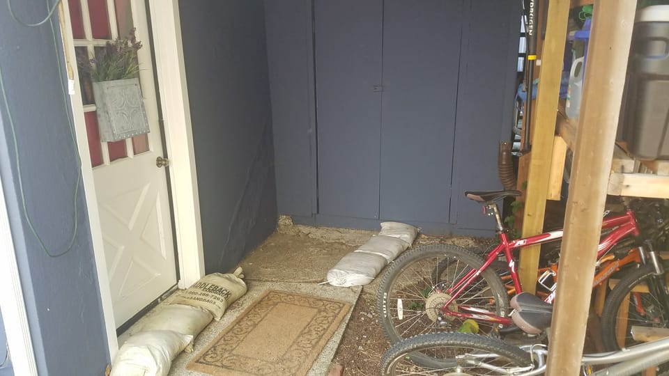
- When the forecast shows 29 feet, get ready. With advance notice, the county says, river residents have time to put out sandbags and leave.[2]
- When the forecast shows your road's number, leave. People who stay past flood stage often need help getting out in high-water vehicles. In the biggest floods, even boats can be unsafe.[2]
- Keep boats off. At 32 feet, the river is closed to boats in Sonoma County until it drops back to 25 feet.[2]
- Keep out of floodwater. As the river rises, local sewers can overflow, and raw sewage can reach the water.[2] If floodwater reached your well, see well water testing before you drink from it.
For getting a house ready, Home Ready Sonoma has a winter storm checklist.
What slows the river down?
Lake Mendocino and Lake Sonoma hold back part of the winter flow. The county credits them with keeping the 1986 flood about 4 feet lower at Guerneville than it would have been.[2] See how full the lakes are going into winter.
The Laguna de Santa Rosa, a large wetland that drains into the river, does quiet work too. In a flood it can hold up to about 26 billion gallons. That may lower flood levels downriver by more than 10 feet. Mud and building are slowly shrinking that room.[2]
Our take: a healthy Laguna is flood protection for the river towns, and habitat at the same time. Keeping soil on the land, upstream and at home, helps both. See how mud in creeks hurts salmon and how to keep rain on your land.
What it means for you
- 32 feet at Guerneville is flood stage. 35 is moderate, 40 is major.
- The worst floods usually come in January and February, after the ground is soaked.
- The river can reach flood stage within a day or two of a storm starting. Sign up for alerts now, and leave before your road floods.
Next: check the Guerneville level and forecast, and read what this winter's El Niño could mean for the river.
Photos by Devan Hemmings unless noted.
Sources
- 1. NOAA National Weather Service, Russian River at Guerneville (GUEC1): flood categories, historic crests and flood impacts
- 2. County of Sonoma, Emergency Operations Plan Annex: Russian River Flood Plan (March 2023, public version)
- 3. National Weather Service, Hydrology Terms and Definitions
- 4. NOAA California-Nevada River Forecast Center, Russian River at Guerneville (GUEC1): forecast, peak stages and flood impacts
- 5. NOAA California-Nevada River Forecast Center, Changes to Flood Thresholds (new flood stage terms, starting fall 2024)
- 6. Sonoma County Hazard Mitigation Plan Update (April 2017), Flood Hazards chapter
- 7. NOAA California-Nevada River Forecast Center, Russian River at Hacienda Bridge (RIOC1)
- 8. NOAA California-Nevada River Forecast Center, Russian River at Healdsburg (HEAC1)
- 9. County of Sonoma, SoCo Emergency: Sign up for Alerts
- 10. County of Sonoma, SoCo Emergency: Flooding in Sonoma County (gauges, road closures, zone lookup)
Checked 2026-11-02. Rules and programs change. If something here is out of date, the source above wins. Spot an error? See our corrections policy.
Related reads
 Rivers and pollutionHow the Russian River works: dams, minimum flows and floodsTwo dams store winter rain and release it in summer. Sonoma Water draws the water from wells beside the river for over 600,000 people. The state sets how much must stay in the river.Updated Oct 18, 2026
 Rivers and pollutionOnly rain down the storm drainStorm drains carry water straight to the nearest creek. It is not treated. Only rain should go down them.Updated Oct 11, 2026
 Rivers and pollutionEl Niño and Sonoma County water: the river, the reservoirs and your rainNOAA says a strong to very strong El Niño is likely this winter, which tilts California toward a wet one. On the Russian River, strong El Niño winters brought a major flood at Guerneville in 3 of 9 cases since 1951, about twice the usual rate, but the worst floods came in other winters. Get ready for high water and plan to keep some of the rain.Updated Oct 18, 2026