
What is a king tide? What causes it, and how to find yours
King tides are the highest high tides of the year at a place, when water reaches farther up the shore than on any ordinary day. They usually come when a new or full moon lines up with the moon's closest pass to Earth. They are predictable, and a storm at the same time can make the flooding much worse.
Listen to this article
Read aloud by an AI voice.
A king tide can put water at the curb on a calm, sunny morning, with no storm in sight.
It doesn't take much. On the California coast, for example, king tides run one to two feet above an average high tide.[1] But on a low road by the water or a path along the beach, a foot or two is enough.
Here is what causes a king tide, how to find the dates on your coast, and why people who plan for rising seas watch it closely.
What causes a king tide?
Tides are very long, slow waves. The pull of the moon and the sun drags the ocean back and forth as they move in their orbits.[2]
Three things line up to make a king tide:
- A new or full moon. Twice a month, the sun, moon and Earth are nearly in a line. The sun's pull adds to the moon's, so high tides run higher and low tides lower. These are called spring tides, from the idea of the tide "springing forth." They have nothing to do with the season.[3]
- The moon at its closest. The moon's path around Earth is an oval. About once every 28 days it swings closest, a point called perigee, and pulls harder.[4]
- Both at once. When a new or full moon lands near perigee, which typically happens 6 to 8 times a year, high tides can run more than a foot higher than spring tides when the moon is farthest away.[4]
"King tide" is the popular name for the highest of these. It isn't a scientific term.[2]
Watch one build
NOAA, the National Oceanic and Atmospheric Administration, is the U.S. agency that predicts tides. The chart shows each day's highest predicted tide at one NOAA station, Point Reyes, on the California coast north of San Francisco. Zero is the average of each day's higher high tide. Look for the climb every two weeks, and the much bigger one about once a month.
The dips in between are neap tides. That is the quiet week when the sun and moon pull at right angles and partly cancel out.[3]
The peaks alternate, small then big. The big ones come when the moon is near perigee. The full moon on November 24 is one of these, what people call a supermoon,[5] and the tide peaks the next day at about 1.4 feet above average. The full moon on Christmas Eve is another supermoon, and its tide is the highest of the season, about 1.7 feet above average.[5][6]
Most ocean coasts follow this rhythm. How big the swing is, and which months bring the highest tides, depends on the place.[4][2]
When is the king tide on your coast?
King tides are a normal event, once or twice a year in coastal areas. In the U.S., NOAA predicts them ahead of time.[7] To find yours:
- Open NOAA's tide predictions page and search for the station nearest you, by name or on the map.[8]
- Set the dates a few months ahead. Scan for the tallest high tides. Those days are your king tides.
- Write down the time of the high tide on each of those days, so you know when to look.
- Check the weather forecast as the day gets close. A storm makes it worse, as the next section explains.
On the California coast? Our sister site Home Ready California lists this winter's king tide times for 11 California places, and how close each comes to its flood line.
Are king tides dangerous?
On a calm day, a king tide mostly floods places that are already low.[4] NOAA calls this high tide flooding. Its minor flood level is 1.8 feet above a place's average high tide, enough to close roads and back up storm drains.[9] On the chart, even the Christmas Eve peak stays under that line.
The bigger danger is a storm on top. Strong onshore winds and low air pressure push extra water onto the coast. A storm that hits during a king tide can flood much more than it would at an ordinary tide.[4]
If you go to look:
- Turn around at flooded roads. Cars can get trapped fast, and salt water damages engines and wiring.[10]
- Never turn your back on the ocean. Stay off seawalls, rocks and bluff edges, where a big wave can come without warning.[10]
- Mind the low tide too. The same days bring extra-low tides that tempt people into tide pools and sea caves. Check when the water turns, so it can't trap you.[10]
- Give wildlife room. Shorebirds and other animals may be much farther up the shore than usual. Let them be.[11]
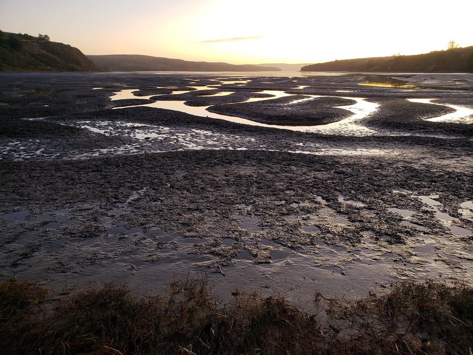
Why king tides are a preview
A king tide shows where water will reach on an ordinary day in the future. As the sea rises, today's highest tides become everyday tides.[7]
It is already happening. High tide flooding in U.S. coastal towns is twice as common as it was 20 years ago, because of rising seas, sinking land and the loss of natural barriers.[9]
That is why many coasts run king tide photo projects. People photograph the high water, and planners and scientists use the pictures to see which places are most at risk.[1] Seeing a path you know at the water's edge says more about a foot of higher sea than any number.
In Sonoma County
If you live here, this is what to know this season.
- The dates are November 24 to 26, December 23 to 25 and January 21 to 22, 2027. Nearby days, December 22 and January 20 or 23, may also run high. The California Coastal Commission's tide map gives times for each spot.[11] Our news post on the dates has more.
- El Niño could push water higher. The Commission says this winter's expected strong El Niño can lift real water above the predictions.[11] See what El Niño could mean here.
- Watch the bay side. Highway 37 crosses the San Pablo Baylands, the marshes at the north end of San Francisco Bay. Flooding closed it in 2017 and 2019, and the State Coastal Conservancy calls it highly vulnerable to rising seas. Millions of waterfowl rest and feed in those marshes on their migration.[12] When high tides threaten the bay shore, the National Weather Service posts coastal flood advisories.
What it means for you
- Look up your king tide dates on NOAA's tide predictions.
- Check the forecast before you go, and turn around at flooded roads.
- Go see one safely, and share a photo with your local king tides project.
Photos by Devan Hemmings unless noted.
Sources
- 1. California Coastal Commission, California King Tides Project: About King Tides
- 2. NOAA National Ocean Service, What is a King Tide? (updated Sept. 23, 2026)
- 3. NOAA National Ocean Service, What are spring and neap tides? (updated Sept. 23, 2026)
- 4. NOAA National Ocean Service, What is a perigean spring tide?
- 5. BBC Sky at Night Magazine, We'll get three supermoons in 2026
- 6. NOAA Tides and Currents, tide predictions and datums, station 9415020 Point Reyes, read Nov. 15, 2026
- 7. US EPA, Climate Change in Coastal Communities: King Tides (updated Sept. 30, 2026)
- 8. NOAA Tides and Currents, Tide Predictions station search
- 9. NOAA National Ocean Service, What is high tide flooding? (updated Sept. 23, 2026)
- 10. California Coastal Commission, Tips for safely viewing and photographing King Tides
- 11. California Coastal Commission, California King Tides Project (dates for 2026 to 2027, read Nov. 15, 2026)
- 12. California State Coastal Conservancy, Highway 37 and the San Pablo Baylands
Checked 2026-11-15. Rules and programs change. If something here is out of date, the source above wins. Spot an error? See our corrections policy.
Related reads
 Stormwater and drainageSlow it, spread it, sink it: downspouts, rain gardens and how big to digTurn your downspouts toward planted ground, put gravel under the roof edge, and slope the soil away from the house. Then, if a test hole drains within a day, dig a shallow rain garden: about 56 square feet for 1,500 square feet of roof draining to it.Updated Oct 19, 2026
 Stormwater and drainageWhen you need a county permit to change drainagePlanning to regrade a yard, add a drain or change how water leaves your property? In unincorporated Sonoma County, drainage work needs a county permit before you start, and moving more than 50 cubic yards of soil needs a grading permit.Updated Oct 18, 2026
 Stormwater and drainageSink it or shed it? When to keep rain on your land and when to drain itMost properties need both. Sink clean water where the soil can take it and nothing will be harmed. Shed water, slowly and safely, where soaking it in would threaten a foundation, a slope, a septic system or a neighbor. The craft is deciding which water goes where.Updated Oct 18, 2026